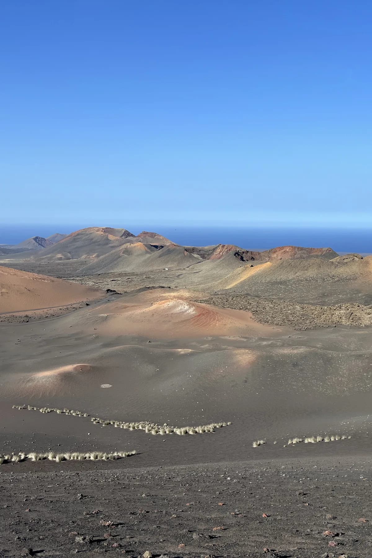
On 1 September 1730, between nine and ten at night, the earth split open near the village of Timanfaya. It did not close again for six years. It was one of the greatest eruptions in the documented history of the planet: some thirty new volcanoes, rivers of lava that buried a dozen villages and covered a quarter of the island. We know it almost day by day thanks to the parish priest of Yaiza, who wrote it all down in a diary that volcanologists the world over cite today. In 1824 the fire returned for three months, more briefly — and since then, silence. This is the story of the event that made the Lanzarote you are standing on.
Few islands in the world can date their own rebirth with this precision: the Lanzarote you know today began on the night of 1 September 1730. That night, recounts the parish priest of Yaiza, Andrés Lorenzo Curbelo, "the earth suddenly opened near Timanfaya" and "an enormous mountain rose up from the bosom of the earth". His diary — the testimony of a man who watched volcanoes being born from the window of his church — is today a document cited by volcanologists all over the world, because very few eruptions on this scale have had a chronicler.
What followed outdoes any film. For six years — 2,053 days, until the spring of 1736 — the earth never stopped working: eruptive vents flared up, died down and reopened kilometres further on, until they totalled some thirty new cones aligned along a fracture more than ten kilometres long. The rivers of lava advanced in every direction: they buried a dozen villages and hamlets — Timanfaya, Tingafa, Mancha Blanca, Santa Catalina, Peña de Palmas and more —, razed the island's best farmland and reached the sea on several fronts, where the water boiled and dead fish floated in their thousands. Ash darkened the sky and rained down over the whole island; the roar, the chronicles say, could be heard on the neighbouring islands.
Miraculously, the lava did not kill anyone directly: it advanced slowly enough to flee from it. The enemy was hunger. With the fields buried and the air thick with ash, much of the population had to emigrate to Gran Canaria, Tenerife or Fuerteventura. Those who stayed lived for six years with their bags packed. When the volcano finally fell silent, in April 1736, a quarter of Lanzarote — some two hundred square kilometres — was brand-new territory: lava and ash where once there had been wheat, vines and bell towers.
And then came the plot twist: the catastrophe turned into an inheritance. The farmers discovered that volcanic ash trapped the night dew, and on top of it they invented a new agriculture — La Geria, the enarenados (cinder-mulched fields) — which gave the island its wines and its most iconic landscape. Almost a century later, in 1824, the subsoil gave its final warning: three brief eruptions — Tao, Nuevo del Fuego and Tinguatón — in barely three months, far smaller, like the closing echo of the great performance.
Since then, two centuries of watchful calm. The Montañas del Fuego (the Fire Mountains) you photograph today are exactly that: the stage of those 2,053 days, preserved almost intact by the lack of rain. You are not looking at a landscape — you are looking at an event.